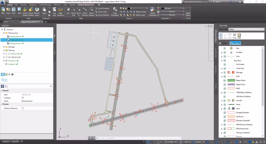
GeoExPT (Geospatial Expeditionary Planning Tool) is a decision support tool for planners providing the ability to build contingency beddown plans, aircraft parking plans, manage airfield damage, and select Minimum Airfield Operating Surfaces (MAOS) in accordance with USAF standards. GeoExPT includes templates, advanced placement and layout tools, constraints analysis, predefined units, sets, components, aircraft, and reports.
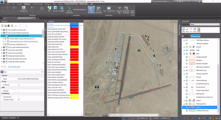
The New GeoExPT for AutoCAD features a fresh interface to improve automated support for contingency beddown planning and sustainment operations. Built to support the mission objectives of contingency planning and sustainment operations with Aircraft Parking, Beddown Planning, and Airfield Damage Repair, the solution has been integrated as a plugin within Autodesk’s AutoCAD Map 3D software. The enhanced user experience provides the engineer with automated planning processes to provide operators with an interactive tool for rapid development of base layout plans and airfield damage repair (ADR).
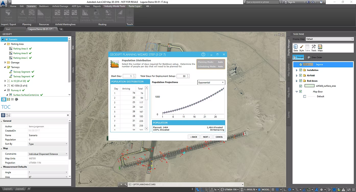
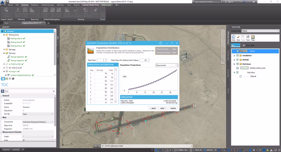
GeoExPT provides the engineer with automated planning process tools to allow for the rapid development of base layout plans. GeoExPT includes approved layout templates, advanced placement and layout tools, constraints analysis, predefined units, sets, components, and beddown planning reports. The Basic Expeditionary Airfield Resources (BEAR) Order of Battle planning wizard and time-phased planning visualization tool, assist the mission planner in developing facility models and beddown plans based on unit population and delivery schedule.
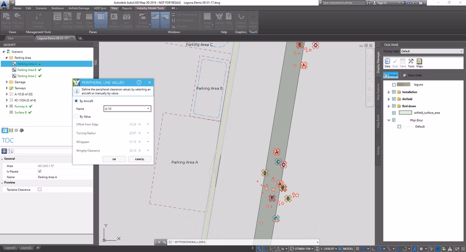
Constraints analysis tools ensure that all standoff distances are met during placement
Advanced placement tools are built-in to allow rapid and uniform placement of features
Asset management ensures that only the required assets are deployed to the Forward Operating Location reducing airlift and ensuring the appropriate quantity and length of assets are provided
Planning wizard, with playbook options, determines the UTC type and quantity based on the population required to be deployed
Time-phased planning visualization tool creates time-phased facility models based on the selected UTCs and delivery schedule; displays beddown plans for each phase of the delivery schedule; and visualize the site at each step in the process
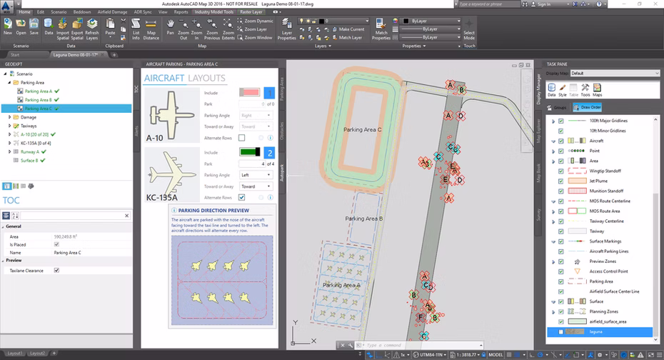
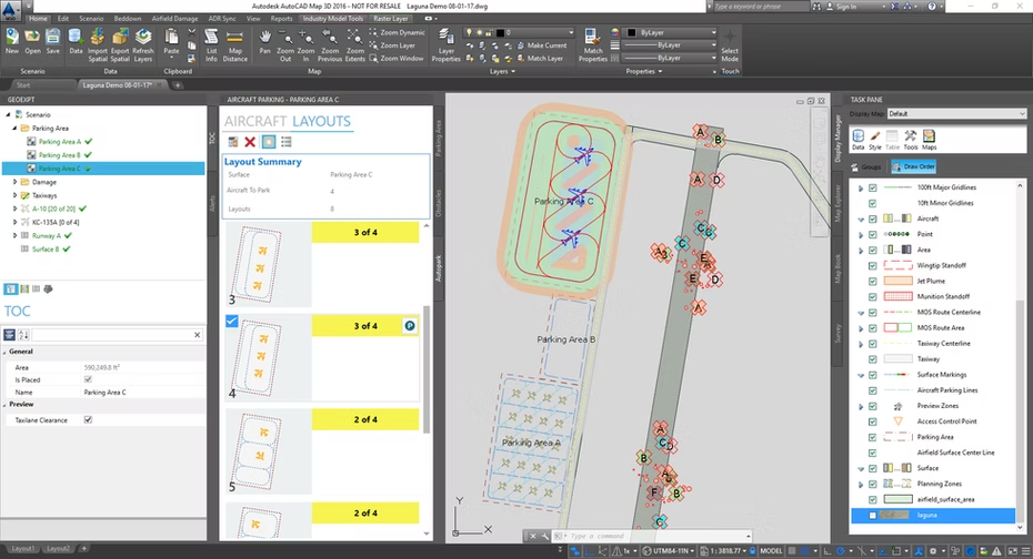
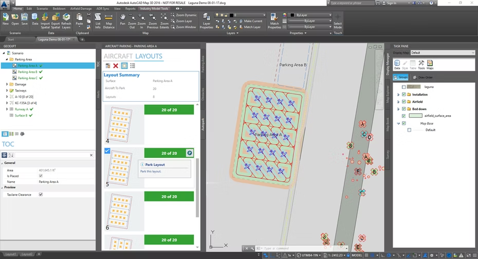
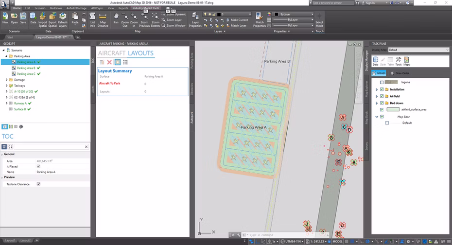
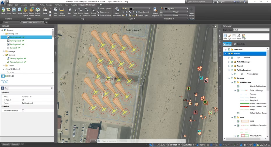
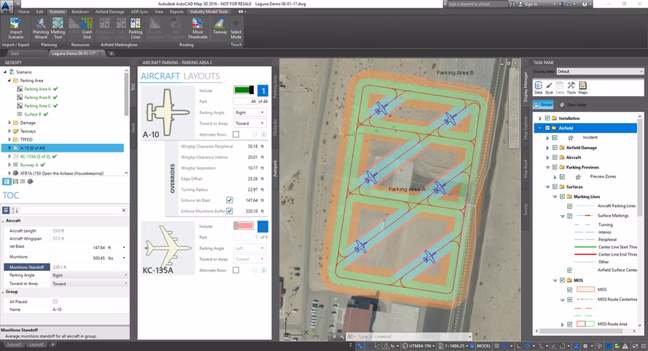
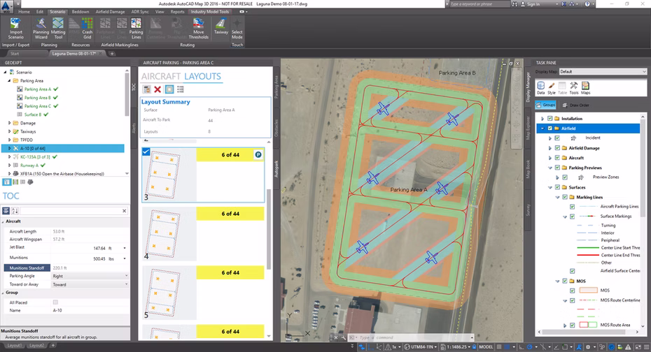
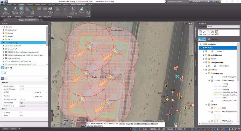
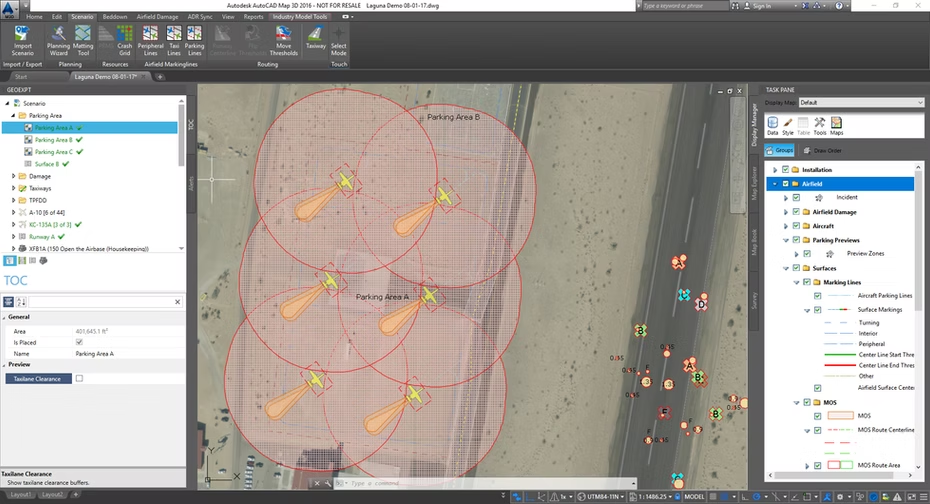
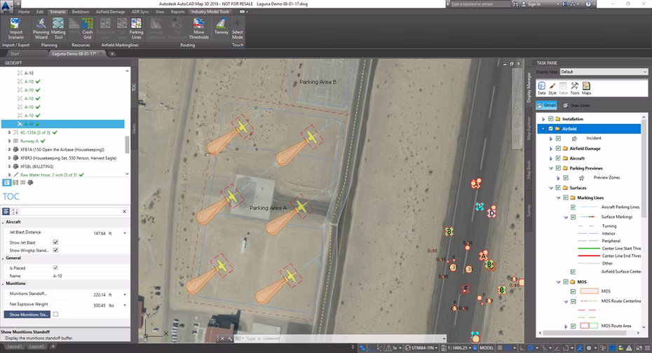
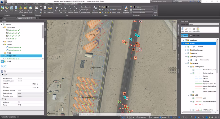
GeoExPT can automatically create parking plans based on established aircraft parking standards and AFI guidelines. GeoExPT uses the appropriate military and DOD standards to create automated aircraft parking plans on designated surfaces with flexible options and multiple solutions.
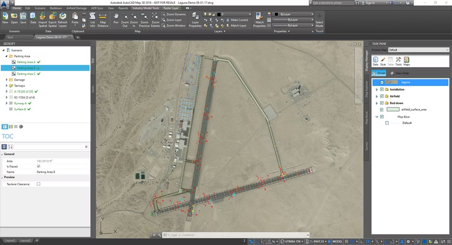
Create parking plans based on military guidelines and restrictions
Define surface Entry Control Points and automatically create all marking lines, including turning radius lines
Take into account munitions standoffs and jet blast during parking
Allow both automatic placement and manual placement modes

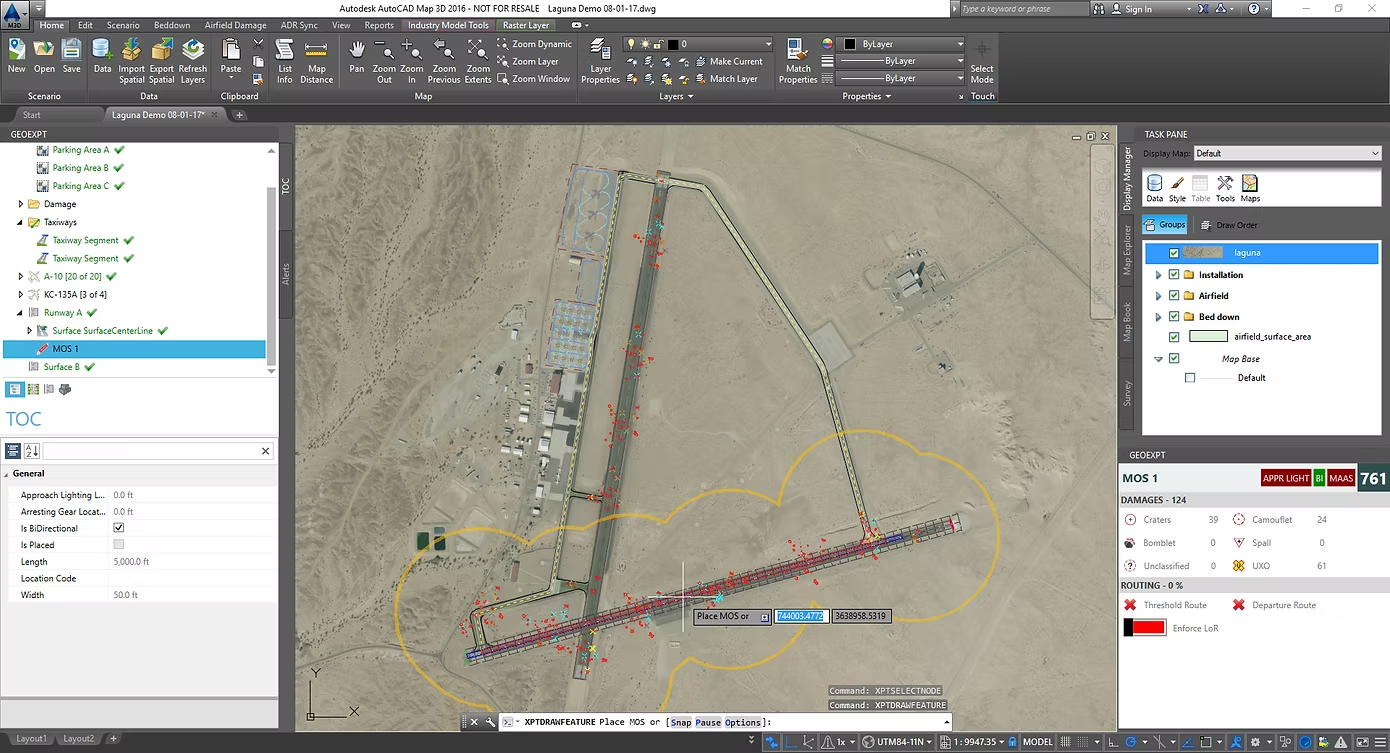
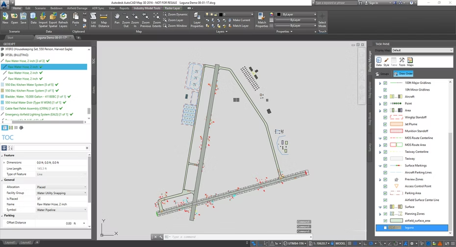
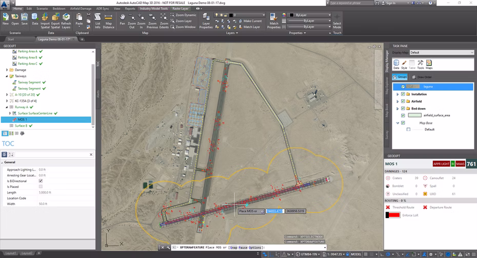
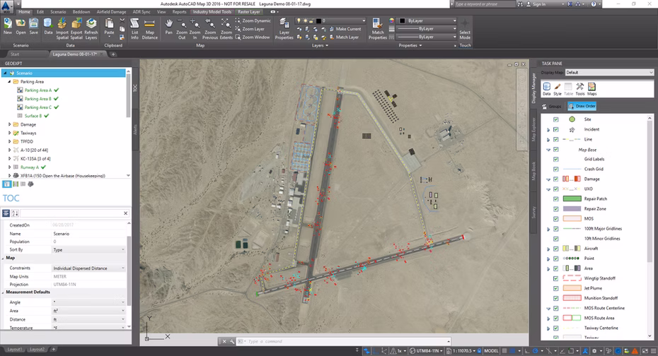
GeoExPT has the ability to plot and manage airfield damage to aid in the creation of a Minimum Airfield Operating Strip (MAOS) for runways. Airfield damage can be plotted, imported, and managed within GeoExPT. It also integrates with the current airfield repair process by providing generation of the Repair Quality Criteria (RQC) Worksheets.
Determine repair times, repair order, and repair quality of damage
Plot and manage all airfield damage from identification to actual repair
Create MAOS for entire airfield including the taxi routes to and from parking surfaces
Automatically calculate RQC value for airfield repair and creates corresponding RQC worksheets
Generate a variety of MAOS and damage reports
DS2 staff members have implemented CONUS/OCONUS base-level training to provide GeoExPT users with hands on experience in using the application to successfully create tent city layouts and aircraft parking plans. The training includes a 2 day course with training slides, exercise guide and user guide. We have provided training to over 17 ACC bases, Silver Flag sites, and other locations as required.
GeoExPT is instructed as part of the core curriculum at the 3E5X1, Engineering Apprentice Course, Eagle Flag, and Silver Flag. Awareness training is also offered at the Air Force Institute of Technology (AFIT) and the United States Air Force Academy (USAFA).
GeoExPT is built on top of the Autodesk platform and can be used with either AutoCAD Map 3D or AutoCAD Civil 3D. Please visit www.GeoExPT.com for more details.

