When airfields are damaged during conflict, restoring the field to an operational state as rapidly as possible is critical. The goal of introducing damage detection algorithms into our software was to enhance automation for detecting runway damage, enabling rapid airfield repair with minimal human intervention. We continue to refine and enhance software solutions that process live drone video feeds to identify damages and unexploded ordnance (UXO), automatically generating damage assessments with precise geospatial coordinates that feed directly into repair planning tools.
Airfield damage assessment traditionally required personnel to manually review reconnaissance imagery, a time-consuming process that delays critical repair operations. This technical challenge involves receiving high-resolution video streams from drones flying over damaged runways, translating that raw video for a machine learning algorithm to process, and finally presenting the detected damage to users for validation and repair decision-making, all while maintaining accuracy and reliability in field conditions.
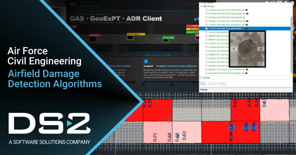
Our new solution uses AI-powered containerized software that automatically processes drone video in real-time. As a drone streams video from a damaged runway, machine learning detection models identify damage features with confidence scores, extract geospatial coordinates from the video metadata, and push the results directly into our GeoExPT planning software. This reduces assessment time, minimizes personnel exposure to hazardous areas, and enables repair teams to make informed decisions faster, all leading to more rapid restoration of operational capability to the airfield.
Now here’s the cleaned-up version that copilot suggested after I fed it my tweaks:
When airfields are damaged during conflict, rapidly restoring them to operational status is critical. Our goal in introducing damage‑detection algorithms into our software was to enhance automation for identifying runway damage, enabling rapid airfield repair with minimal human intervention. We continue to refine and expand software solutions that process live drone video feeds to identify damage and unexploded ordnance (UXO), automatically generating detailed assessments with precise geospatial coordinates that feed directly into repair planning tools.
Traditionally, airfield damage assessment required personnel to manually review reconnaissance imagery; a time‑consuming process that delays essential repair operations. The technical challenge lies in receiving high‑resolution video streams from drones flying over damaged runways, translating that raw video into a format optimized for machine‑learning processing, and presenting detected damage to users for validation and decision‑making, all while maintaining accuracy and reliability in real-world field conditions.
Our new solution uses AI‑powered, containerized software to automatically process drone video in real time. As a drone streams video from a damaged runway, machine‑learning detection models identify damage features with associated confidence scores, extract geospatial coordinates from embedded metadata, and push results directly into our GeoExPT planning software. This capability reduces assessment time, minimizes personnel exposure to hazardous areas, and enables repair teams to make faster, better‑informed decisions – ultimately accelerating restoration of operational capability to the airfield.